

Travel the Gentle Annie
There are roads that get you from A to B. And then there are roads where getting there is half the fun.
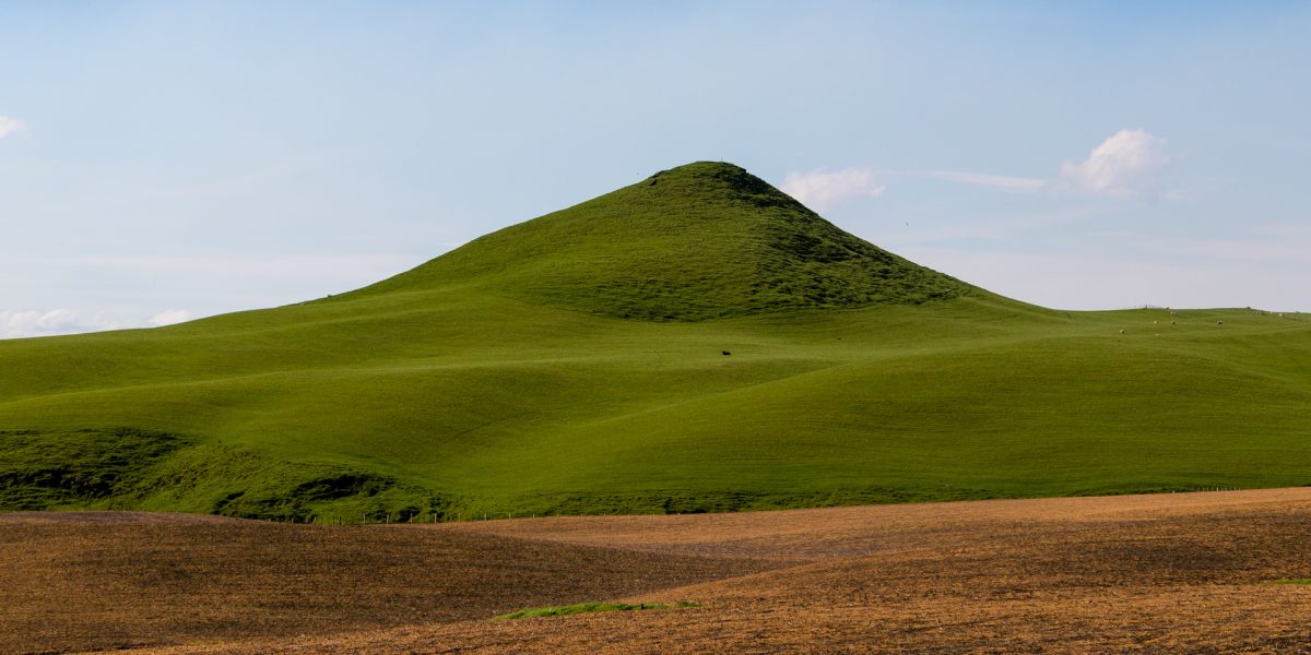
Winding its way east from Taihape across some of the North Island's most remote high country, the Taihape–Napier Road (better known as the Gentle Annie) is definitely the latter. It's a journey of big skies, steep hills and seemingly endless views. One minute you're travelling through rolling farmland and tussock-covered high country, the next you're descending through steep hill country towards the Rangitīkei River before climbing again towards the Kaweka Range and eventually descending into Hawke's Bay.
Today, it's one of the North Island's great road trips. But people have been making their way through this landscape for centuries.
A journey centuries in the making
The landscape may appear remote today, but it has a long history of people moving through it, living from it and maintaining connections across it. Long before the current road, Māori travelled through the vast inland high country known as Mōkai Pātea, with trails connecting communities around the headwaters of the Rangitīkei, Moawhango and Hautapu rivers with areas further east towards Te Matau-a-Māui (Hawke's Bay). Meaning “the hook of Māui”, the name reflects the shape of the bay and its connection to the story of Māui fishing up Te Ika-a-Māui, the North Island. Some of these established routes would later help shape travel through the high country as European settlement brought a new chapter to the story.
During the nineteenth century, pastoral farming expanded across the Rangitīkei high country, with areas of native forest cleared and large sheep stations established across the landscape. But there was one fairly significant problem: getting their wool out.
Before the railway reached the central North Island, wool and supplies had to make the long journey across difficult country towards Hawke's Bay. Bullock teams, horses and pack animals followed tracks and trails through the high country, some of which would eventually help shape the route of the Gentle Annie. Over time, those rough routes began to give way to a more established road. By 1883, the road from Napier had reached Moawhango, strengthening an important connection between the communities around Taihape and Moawhango and those further east towards Napier.
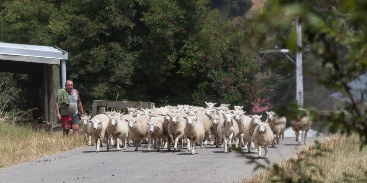
Moawhango itself has a much deeper history. The area is an important centre for local iwi and hapū, with Moawhango Marae at the heart of the community, while the surrounding high country became home to some of the region's great farming stations.
For those farms, the new road provided an essential route east, allowing wool, supplies and people to travel between the isolated high country and Napier. Over time, this remote landscape wasn't quite so isolated.
Not quite so gentle
Exactly how Gentle Annie got her name depends on who you ask. The name is generally associated with the steep descent towards the Taruarau Valley and Kaweka country, a stretch of road that probably didn't feel particularly “gentle” to anyone hauling wool across it. Another piece of local folklore attributes the name to a woman known as Gentle Annie who was associated with accommodation along the route. Whatever the true origin, the name stuck. And eventually it came to describe not just the hill, but the incredible journey between Taihape and Napier. For generations, travelling the road was an adventure in itself. It was remote, winding and largely unsealed, with steep climbs and descents that demanded plenty from vehicles and drivers alike.
Today, the Taihape–Napier Road is sealed, making the journey considerably more comfortable.
High-country Rangitīkei
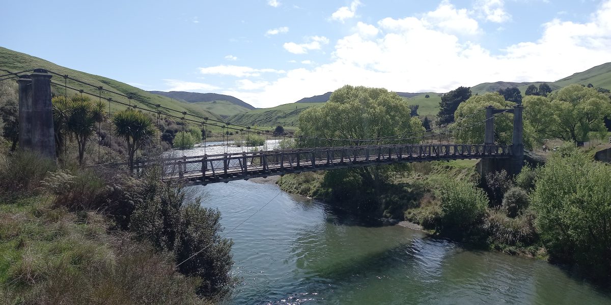
Leaving Taihape, and once you pass through Moawhango, the houses begin to thin and the surrounding high-country farming landscape takes over, creating a real sense of remoteness. Then comes one of the highlights. The road winds its way down through the hill country towards the Rangitīkei River, where the landscape opens up around one of the most memorable stops on the journey. Here, the modern road bridge crosses the river alongside the historic Springvale Suspension Bridge, which carried traffic across the Rangitīkei from 1925 until the road was realigned and a new bridge constructed in 1970.
Today, the old bridge remains as a striking reminder of just how much travelling this remote route has changed over the past century. The reserve beside the river also offers a spectacular place to stop, with travellers able to camp surrounded by the hills and the sound of the Rangitīkei flowing nearby.
As the road climbs away from the river, on a clear day you may be rewarded with views back towards the volcanoes of the Central Plateau. From there, the road continues across exposed tussock country towards the Kaweka Range. Eventually the landscape changes again. The road crosses the Ngaruroro River near Kuripapango and continues its journey towards Hawke's Bay. Hill country gradually gives way to the plains, and landmarks such as Te Mata Peak and Cape Kidnappers may appear in the distance.
In the space of a few hours, you've travelled between two remarkably different parts of Aotearoa.
Take it on two wheels
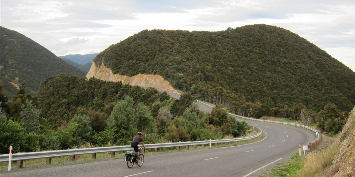
For some people, driving the Gentle Annie isn't challenging enough. The route has also become one of New Zealand's recognised Heartland Rides, attracting cyclists prepared to tackle around 136 kilometres of remote and seriously hilly country between Taihape and Napier.
It's not exactly a leisurely Sunday pedal. Long climbs, steep descents, exposed high country and very limited services make it a genuine adventure. But those willing to take it on are rewarded with one of New Zealand's most spectacular cycling journeys.
Whether you're travelling on two wheels or four, though, this isn't a road to rush.
Take the memorable road.
Stop at the Rangitīkei River. Look back towards the mountains. Take in the silence of the high country and appreciate just how far you are from the bustle of everyday life.
For generations, people have travelled through this landscape for trade, farming, work and to maintain connections between communities on either side of the ranges.
Today, we're lucky enough to be able to travel it simply for the experience. So next time you're leaving Taihape and heading east, don't just think about where you're going. Enjoy getting there.